

The context
- Until 2018, Zurich public transports (VBZ) handled their information about contact lines with CAD solutions.
- Within the scope of a project about renewal and homogenization of these dataset, the entire network (tram and trolleybus) needed to be re-surveyed in 3D and structured in database model in order to allow a future integration in GIS .
Necessary conditions
The network includes thousands of infrastructure elements that must be captured in 3D and given the correct attribute according to a list of element’s kind.
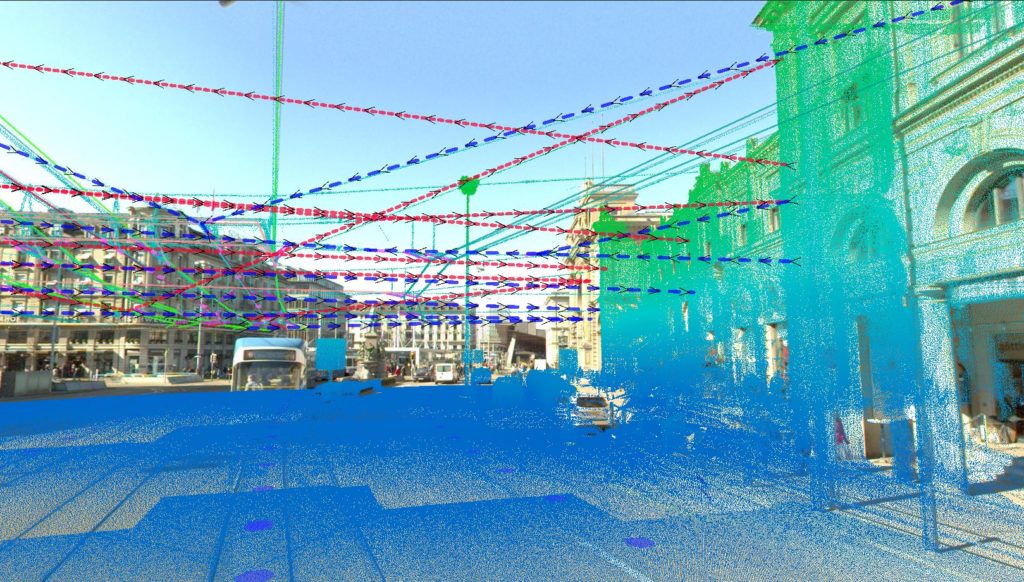
- Elements that need to be captured (contact lines, tie points) are sometimes very small and hardly visible to the naked eye.
- Objects need to be surveyed with an high precision
- The exact survey with classic methods (GPS/tacheometer) takes a lot of time and can potentially disturb the network’s use.
- Correct identification of elements requires, besides 3D coordinates, visual informations.
- The data must be usable in different contexts (CAD, GIS, web).
Possible solutions
The network includes thousands of infrastructure elements that must be captured in 3D and given the correct attribute according to a list of element’s kind.
- The entire network is captured in mobile mapping in order to have a base for a 3D survey and to allow an integration into a GIS solution.
- The systems has two high precision scanners with pulsed technology. These scanners are able to detect very thin elements (cables) with an high definition as well. Thereby, survey’s exhaustiveness and absolute precision requested by the client can be guaranteed for any kind of object.
- 360° geo-referenced images taken at the same time give a visual overview of the elements, allowing an unequivocal identification as well as an attribution of the kind of elements captured.
- Concerning the contact lines vectorization, laser and images are combined in order to provide a quick input of the requested elements (3D positioning, topology, attribute assignations) with respect of the GIS dataset model given by VBZ.
Assessment
With the mobile system deployed, network’s elements, contact lines.. can be captured very quickly and without any line closure. This significantly reduces the survey’s impact on the use of the network.
Concerning the treatment and data visualization, several options are possible:
- Development of a flexible and independent workflow, allowing to move the data into the wanted dataset model
- Data publication on a 3D web platform : It enables, besides the surveys’ visualizations in their contexts, to make additional measurements not done in the initial dataset model
- The combination of 3D capture of contact lines with existing data (such as rails, signs, stops infrastructures…) is recommended in order to display and export of combined products.