Mobile mapping is a solution of choice for an efficient and accurate input of every element of a railroad network. Image and laser sensors combined in a mobile system usable on rails allows us to complete three major application:

  • Visual inspection of facilities’ condition
  • 3D capture of the environment (ballast, banks, free templates, tunnels, galleries)
  • Railroad infrastructures surveying: Lines of contact, railroads, signs, etc.

Fast and secure …

Modern mobile measurements systems allows surveys up to 100Km/h without a significant loss of the data’s quality. Large railroads sections can be plotted in a short period of time. Mobile mapping is also a non-invasive method because no human presence is required on the rails. These factors represent considerable advantages for the manager:
  • No service interruption required:the speed allows to insert the train, which is surveying, between the plan compositions.
  • The workers’ safety is guaranteed: There is no need to deploy railroads security in order to do the measurements.

Data source rich in information …

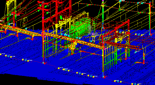
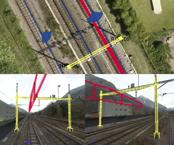
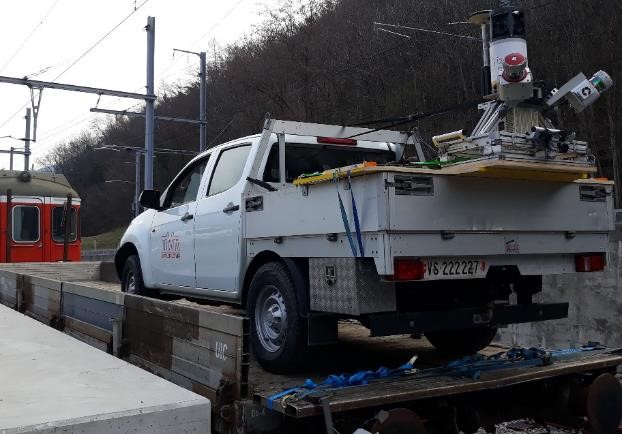
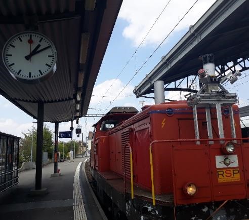
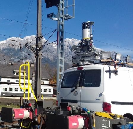
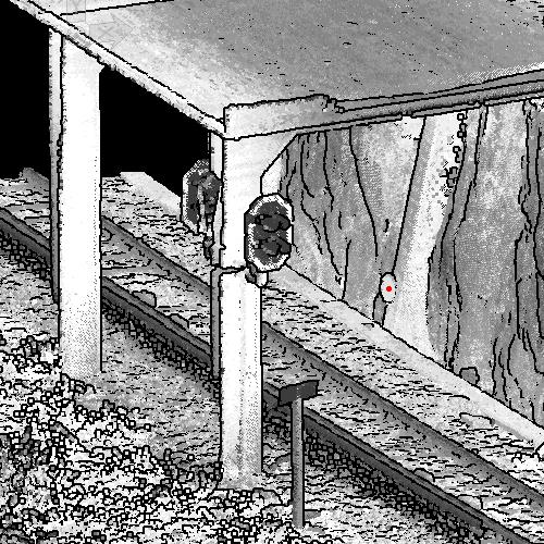
Scanners with the pulsed lidar technology (as deployed on our systems) are capable to detect very small objects and give a very high density point cloud, allowing to capture every railroad installations details including cables of contact lines. Combination with imaging helps to identify the measured objects. Among other thigs, this enables to:

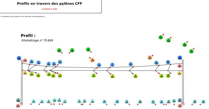
  • Digitalize every element of the contact line,
  • Capture therailroad’s geometry with high accuracy,
  • Detect exterior elements (such as vegetation or other cables ..) threatening the contact lines.

Great set-up flexibility …

Depending on the on wheel equipment available, the network’s typology (road’s width, topography) and sensors used (Laser and/or 360° images), different set up solution are necessary:

  • Set-up directly on the rolling vehicle: Depending on the room available the system can be set-up on the front of a locomotive or on a low wagon.
  • Set-un on a road vehicle: this solution can be useful on lines going through strong GNSS disruptions (assembly lines with tunnels /galleries) where the alignment of the mobile system with the road is recommended.

Precision guaranteed everywhere…

Railroads networks are often equipped with reference points at regular distances. Those point can be seen along with special targets which allow an accurate detection in the point cloud and data registration.

Thanks to registration algorithms

on detected points from the measurements, mobile mapping can give precise results in an environment without GPS signal as well (tunnels, parking lots, urban environment). Thereby, precision around 1-2cm (1σ) can be reached by the point cloud even on sections in galleries or tunnel.

Railroads firms working with us